
Permaculture design software for real sites
Megumi Planner is a permaculture design app that works on a scale plan of the real site. Draw zones 0 to 5 around the house, shape the ground and lay swales on contour, run a rainstorm to see where the water goes, and build guilds and food forest layers. Then hand your client a printed design document or a view-only link.
Start planning – free Free plan, free forever. No card needed.
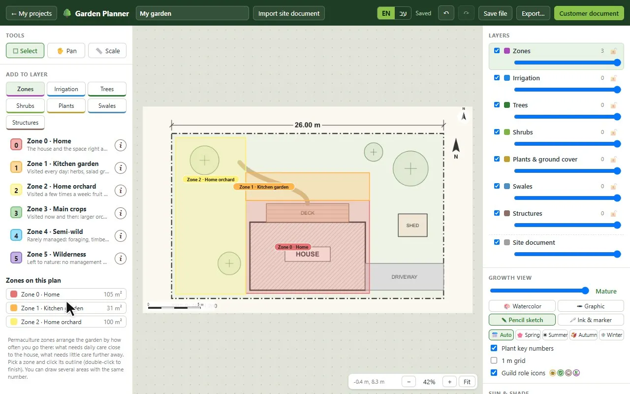
Zones 0 to 5
Draw zones as coloured areas by how often you visit each part of the site: the house (0), the kitchen garden you pass every day (1), the home orchard (2), main crops and pasture (3), semi-wild land (4) and wilderness (5). Each zone has an info window with what usually goes there and a design tip.
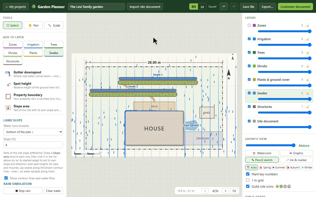
Slope, swales and rain
Set which way the land slopes, draw slope areas where it changes, and add spot heights. Contour lines help you lay swales level, and each swale shows whether it is level and how many litres it holds. Add spillways, rain gardens, tanks and roof downspouts, draw the property boundary, then start the rain: water runs downhill, around buildings and into the swales, with a live tally of what was caught, soaked in and lost.
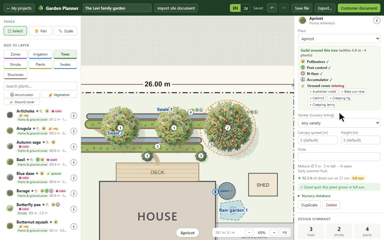
Guilds and food forest layers
Every plant carries its guild roles – nitrogen fixer, pollinator plant, pest control, nutrient accumulator. Select a tree to see which roles are covered around it and add the missing ones in a click; the design summary shows which of the seven food forest layers you have. Or plant a whole bed in the forest garden style and let the planner place trees, shrubs, herbs and ground cover.
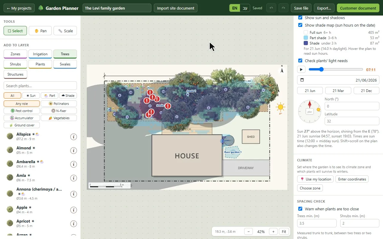
Sun and shade
Set the latitude and where north is, then move the sun through the day and the year. The shade map shows hours of direct sun on any date, and the light check flags every plant that sits in the wrong light. Where the garden is also sets its climate, and plants that won’t grow there are marked.
Zone 1: beds, greenhouse and irrigation
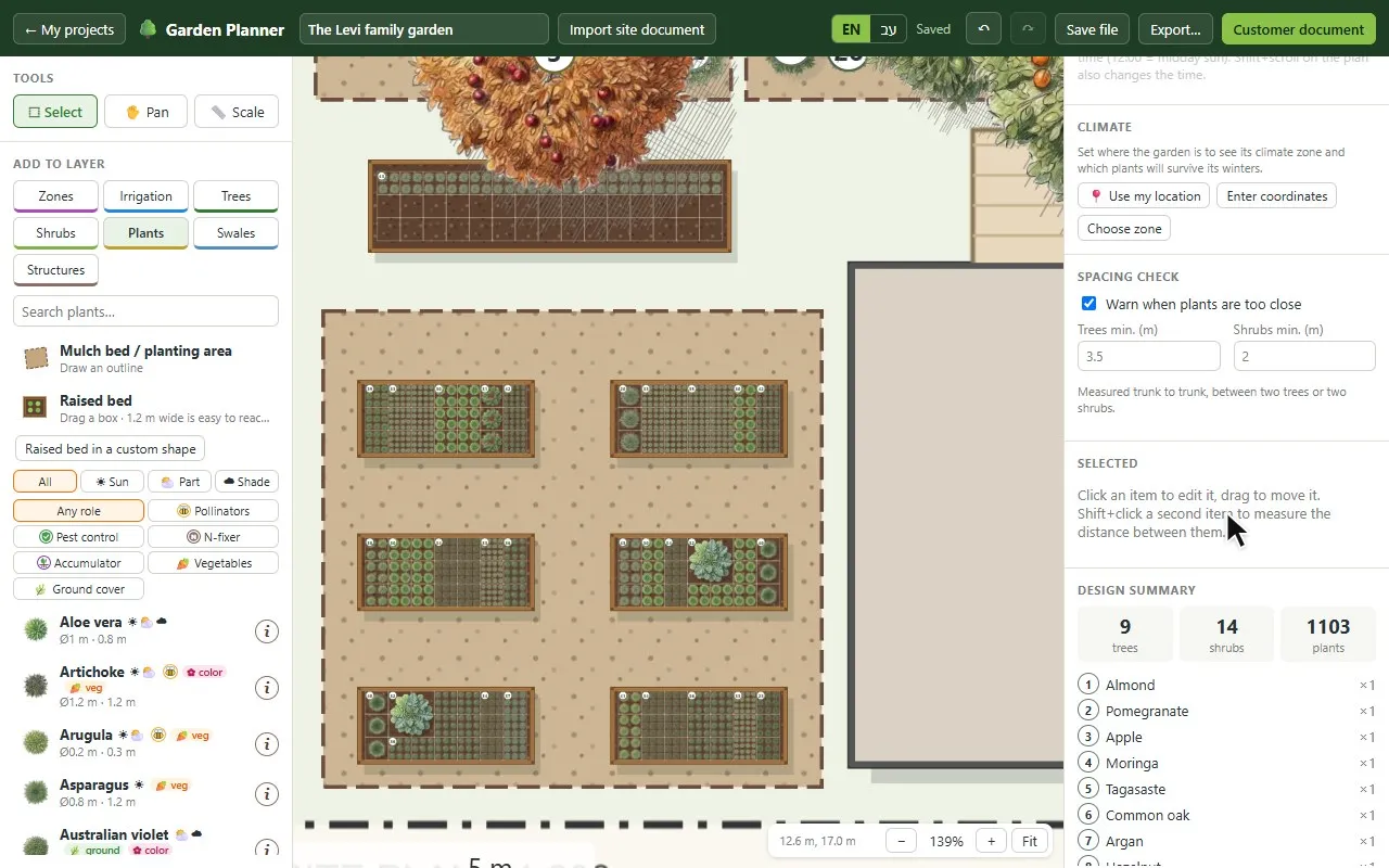
Close to the house, draw raised beds and fill them square by square with seasonal vegetables, and place a greenhouse and a composter. Drip lines, drip rings, valves and sprinklers come with a parts list of every pipe and fitting.
Documents for clients and courses
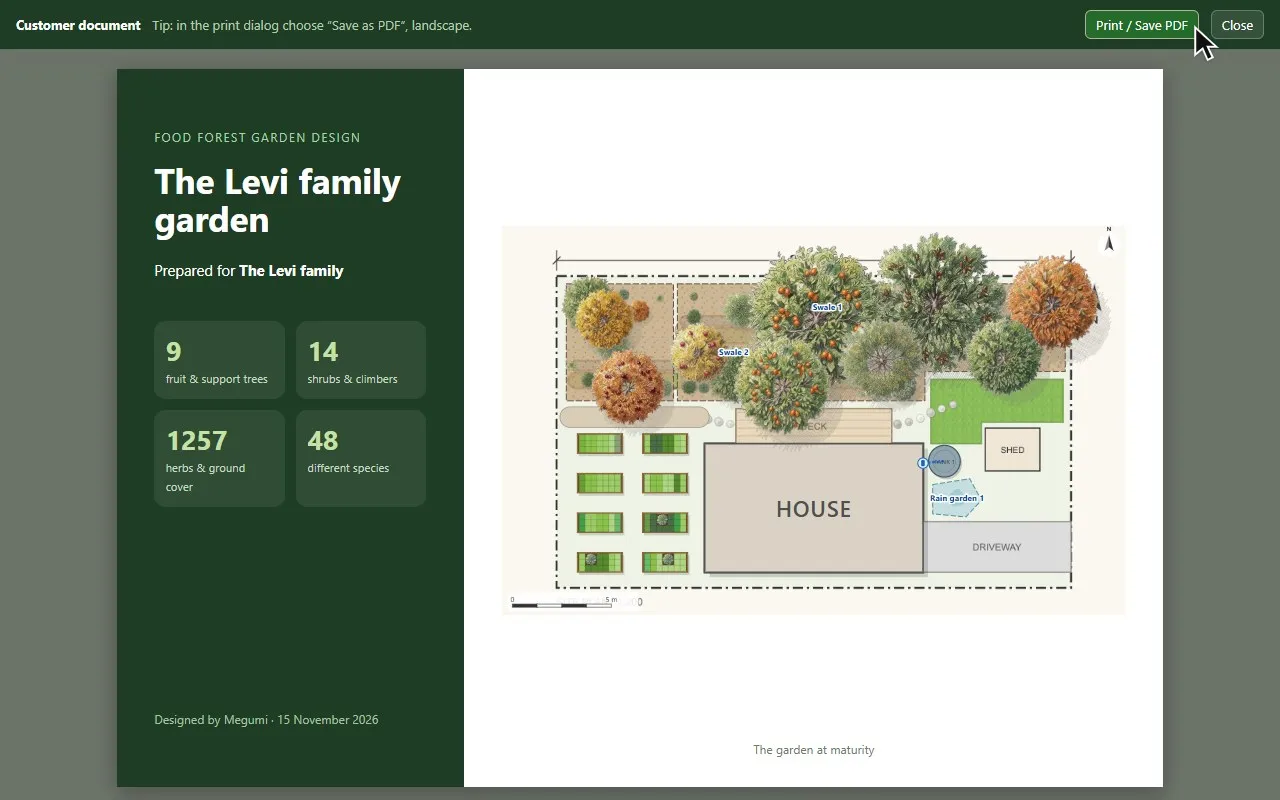
The Garden plan document builds the presentation: cover, existing site, planting plan with legend, irrigation plan with quantities, growth over time, plant schedule, a food forest page and, when there are swales, a water harvesting page. Print it or save it as PDF, send a view-only link, or export a DXF drawing for the architect.
How it works, in four steps
- Bring in the site: import a survey, a DXF drawing or a Google Earth outline – a Google Earth file also sets the location, the sun and the climate.
- Draw the zones from the house outwards, and mark the slope, the roofs and the property boundary.
- Lay swales on contour, run a rainstorm, and adjust until the water stays on the land.
- Place trees in guilds, beds in zone 1 and the irrigation, then print the design document.
Questions about permaculture design
What is permaculture design?
A way of designing a garden, farm or home as a whole system that largely looks after itself, based on three ethics – care for the earth, care for people, fair share – and on careful observation of the site. Instead of placing plants one by one, you plan how sun, water, soil, plants, animals and people work together.
What are permaculture zones?
Zones number the parts of a site by how often you go there, from the house (zone 0) out to wild land (zone 5). Things you need every day – herbs, salad, compost – go in zone 1, near the door; fruit trees and chickens in zone 2; main crops and water storage in zone 3. It saves steps and keeps the busiest parts well looked after.
Is there free permaculture design software?
Yes. Megumi Planner has a Free plan that stays free, and during the beta every account gets every feature – zones, swales, the rain simulation, guilds and the Garden plan document. It runs in the browser on any computer, with nothing to install.
Can I use it for client designs?
Yes. It is made first for ecological, permaculture and landscape designers: a plan to scale, a printable Garden plan document in English or Hebrew, a view-only link the client can open on a phone, and DXF export for architects.
How do I design a swale?
A swale is a level ditch dug along the contour, with a planted mound (berm) on its downhill side. It slows the rain, spreads it and lets it soak in. Lay it exactly level, give it a spillway where a full swale can overflow safely, and plant trees on the berm. The planner checks whether each swale is level and shows how many litres it holds.
Further reading on the blog
Planning a different kind of garden?
Design the whole system, not just the planting
Zones, water, sun and plants on one plan – then a document your client can hold. Start your first permaculture design now.